
Drawing your own custom boundary is simple and lets you be the expert! It also helps to expedite our process!
Please follow the instructions below to draw a custom boundary using geojson.io
STEP 1: Use the search function or pan to locate the city you want to add shapes for.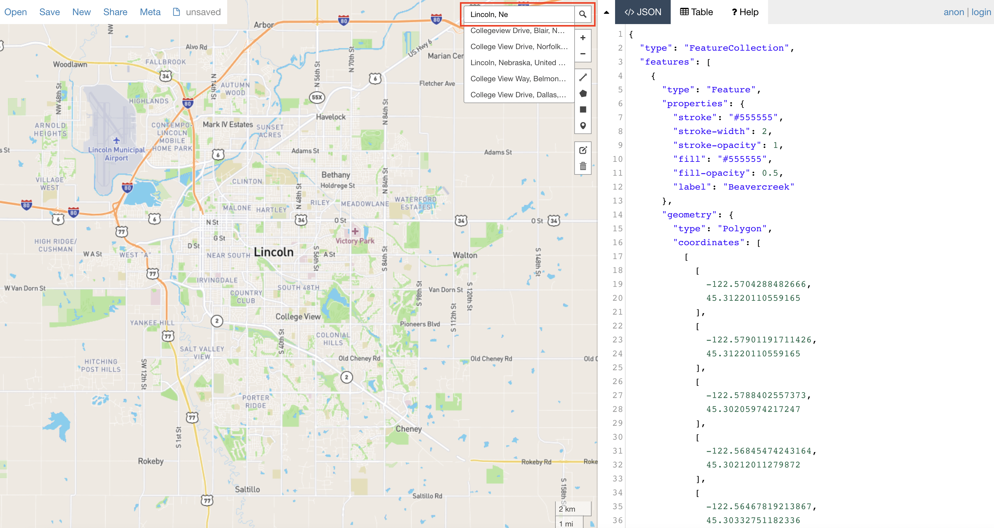
STEP 2: From the toolbar on the right hand side of the screen select the 'draw polygon'
feature. It's the pentagon icon.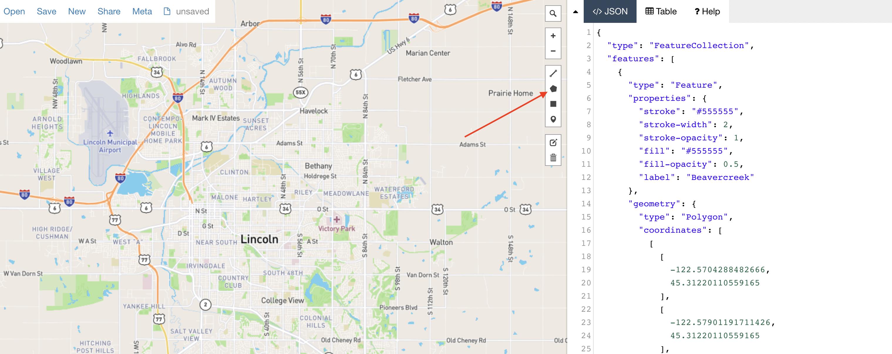
STEP 3: Select the points that make up the boundary with a single click. Close the shape
by clicking once on the first point. This will shade in your selection.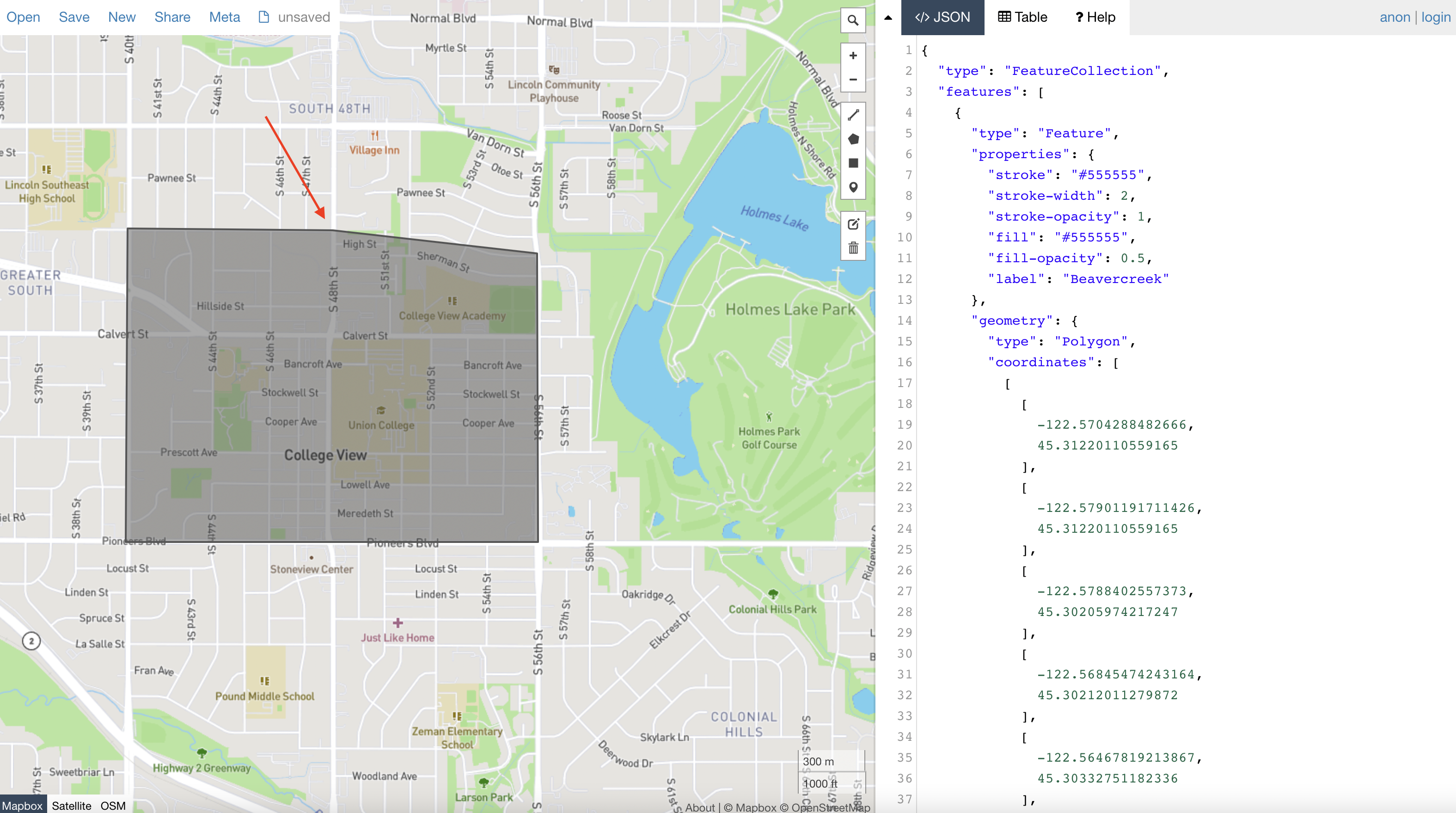
STEP 4: Once your shape is drawn, click on it once to open the shape properties table. You
will now need to label the boundary. In the bottom row of the table, under 'fill-opacity' add the
word ‘label’. In the next column enter the name of the community and click SAVE.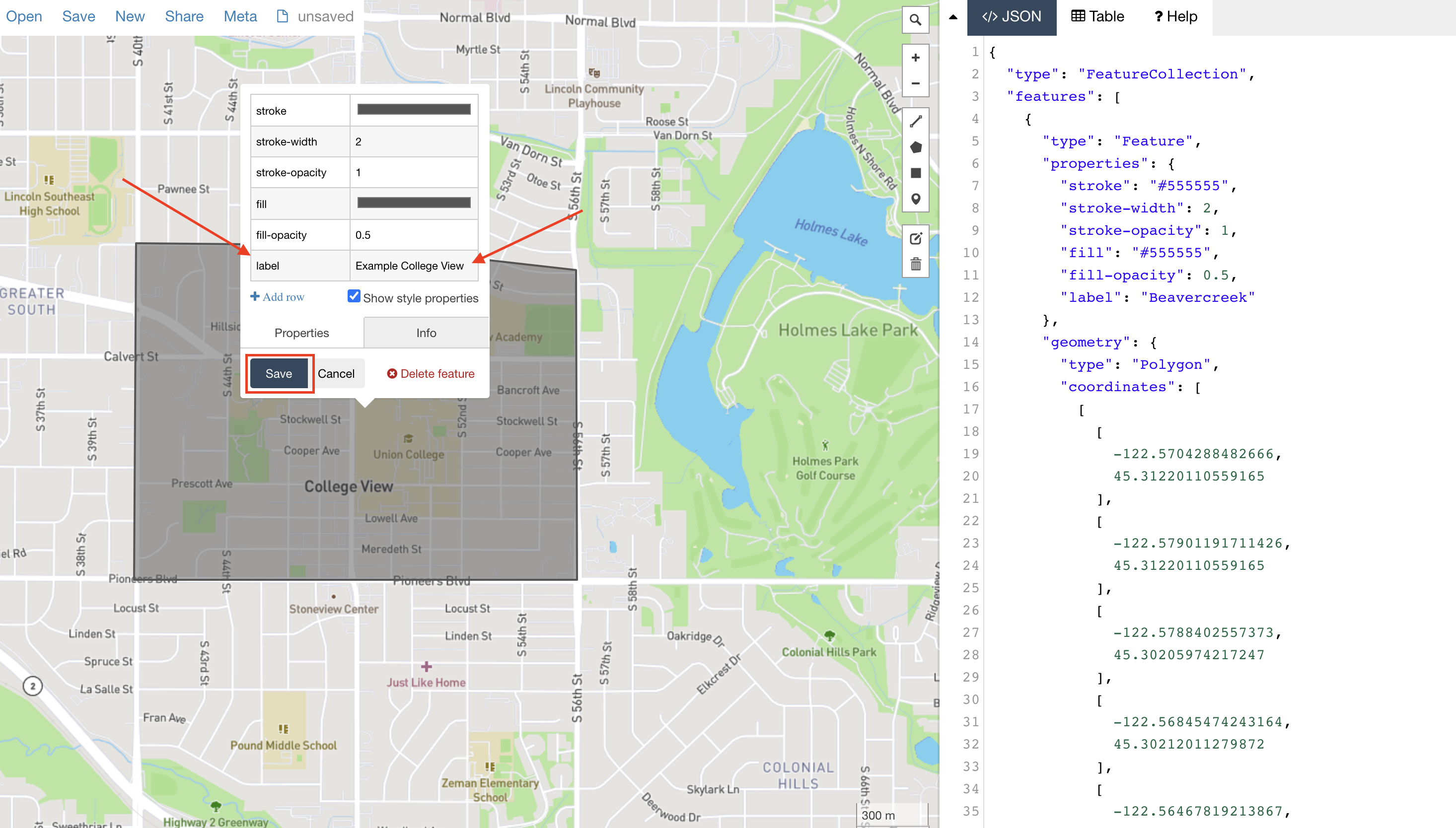 At this point, you can continue adding more boundaries in the same area by repeating the
process, or you can download the file to share with LiveBy.
STEP 5: Using the menu in the top left corner of the screen, hover over the word 'save.' When hovering, a drop-down menu will appear. Select 'GeoJSON' to download.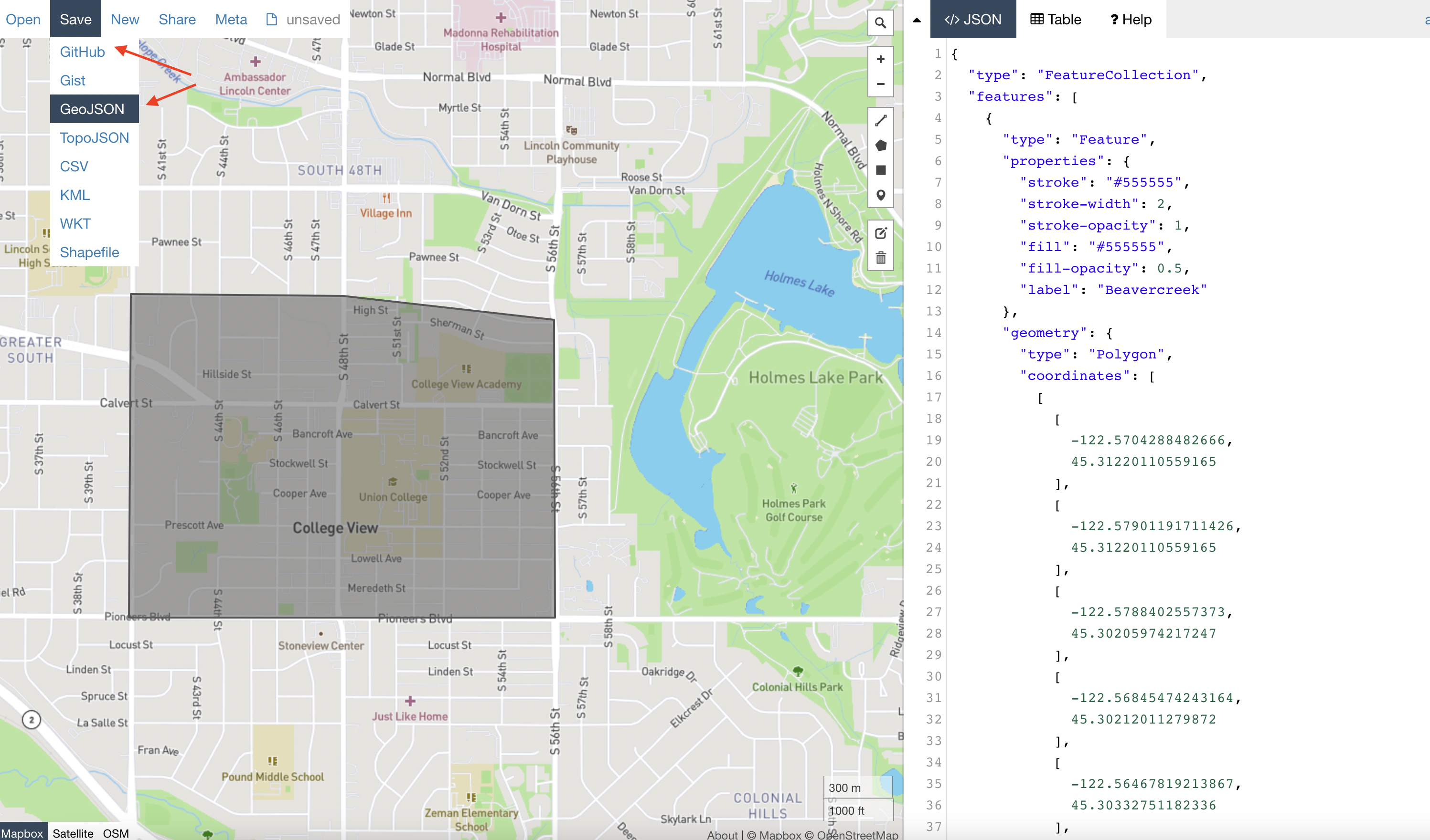
Comments
0 comments
Article is closed for comments.